(334) 285-6428
  admin@cityofmillbrook.org
 3160 Main Street, Millbrook, AL 36054


Welcome to the
City of Millbrook, Alabama
The mission of the City of Millbrook is to provide sound leadership and effective management of public resources and to provide for the general welfare of its citizens by ensuring Millbrook is a safe and prosperous community, by participating in community and economic development, by affording the best possible quality of life to all citizens, and by encouraging citizen involvement.
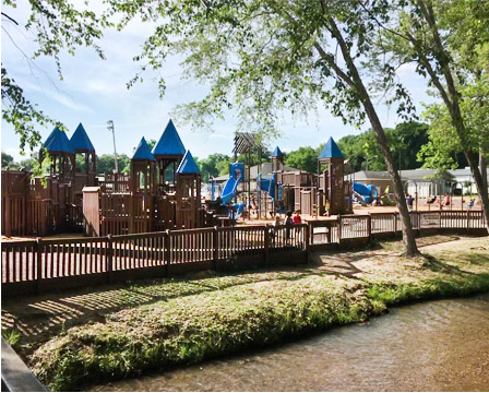
Learn More About Seventeen Springs
Grandview Road Has REOPENED
Grandview Road Near Oak Tree Road has reopened. Please use caution in the area as paving operations will be forthcoming..
New Material Drop Off Available
The Millbrook Street Department has stopped holding Clean Up Day and will be able to accept material at the Recycling Center located at 4180 Grandview Road, Across from the Millbrook Street Department.
We will be able to take materials during the recycling center hours.
The Following Rules will apply:
No Tires or Paint
No Household Garbage
No Hauling Services or Contractors
Please be able to provide Identification or Proof of Residency in Millbrook
Any questions, Please contact the Millbrook Street Department at 334 285 3653
Calendar of Events
- MO
- TU
- WE
- TH
- FR
- SA
- SU
- 1
- 2
- 3
- 4
- 5
- 6
- 7
Events for April
1
Events for April
2
Events for April
3
Events for April
4
Events for April
5
Events for April
6
Events for April
7
- 8
- 9
- 10
- 11
- 12
- 13
- 14
Events for April
8
Events for April
10
Events for April
11
Events for April
12
Events for April
13
Events for April
14
- 15
- 16
- 17
- 18
- 19
- 20
- 21
Events for April
15
Events for April
16
Events for April
17
Events for April
18
Events for April
19
Events for April
20
Events for April
21
- 22
- 23
- 24
- 25
- 26
- 27
- 28
Events for April
22
Events for April
24
Events for April
25
Events for April
26
Events for April
27
Events for April
28
- 29
- 30
- 1
- 2
- 3
- 4
- 5